
Search a Le Ray Street
A Town of Le Ray street directory search works best as a short chain, not as a list of assumed occupants. Write down the house number, street spelling, postal city, ZIP, and any tax-map number already known. First test the address against the postal tool and the county parcel record. Then use the parcel, not a surname alone, to compare the map and land records. A property owner, a deed party, and a voter registration are different roles. The result should preserve that difference rather than turn a matching name into a claim about residence.
For a current street question, use the newest available parcel and map information first. For an older address question, work backward through the deed description and a dated directory entry. The New York voter lookup is a permitted individual lookup with identifying inputs, not a street-browse roster. It cannot be used to build a block list.
- Check the full address with the USPS ZIP Lookup Tool, keeping the returned postal city and ZIP with the original address.
- Search the Jefferson County Parcel Data and Tax Bill Lookup by address and note the selected parcel and owner field.
- Open the parcel in the county GIS viewer to compare its boundary, road position, and municipal context.
- Follow the legal description through the County Clerk deed index, then ask the office or Records Management for older material when the online route stops.
- Use a dated directory or library source only as a historical address-to-name lead, then seek a confirming record.
Le Ray Parcel Fields by Address
The county-linked SDG parcel portal is the first official address record for many Town of Le Ray street directory searches. County instructions document searches by Tax Map Number, Name or owner, and Address. After selecting a parcel, the portal offers Tax Info and a View Tax Bills or Payment Status action. The portal serves parcels outside the City of Watertown and can show RPS data, tax maps, and property images. A name in its owner field identifies a property-record relationship. It does not establish current occupancy.
| SDG field or action | Format observed | Street-directory use |
|---|---|---|
| Tax Map Number | Text; optional in county-linked instructions | Connects an address with the selected parcel |
| Name / owner | Text; owner-name search documented | Tests a recorded owner field after a parcel is identified |
| Address | Text; address search documented | Finds the parcel's situs record |
| Tax Info | Action after parcel selection | Opens tax context for the selected parcel |
| View Tax Bills / Payment Status | Action after parcel selection | Shows tax and payment detail when available |
Capture the assessment or tax year and the source date with any Town of Le Ray street result. The live card's required flags, result controls, and export options were not exposed during research, so they should not be guessed. Mailing address and situs address need separate notes. The situs is the parcel location; a mailing address may belong to a party elsewhere.
Note: A county parcel result is useful for property context, but it is not a current household roster.
Le Ray GIS Layers on Streets
For Town of Le Ray street work, the Jefferson County GIS and property-search gateway connects the parcel question with map context. County documentation describes aerial imagery, agricultural districts, existing land use, zoning, school and election information, flood data, and related planning layers. Those layers help distinguish a street name, parcel boundary, district, or municipal setting. They do not identify a resident.
The same map view helps when a postal label and a town boundary do not agree. Locate the subject parcel, compare the boundary and road geometry, then record its parcel ID before opening a tax record. The live viewer's exact identify, adjacent-select, buffer, export, and pagination controls were not confirmed. Use only controls visible in the active session, and retain the map date where the viewer supplies one.
The county's GIS and parcel gateway is shown in the official source page.
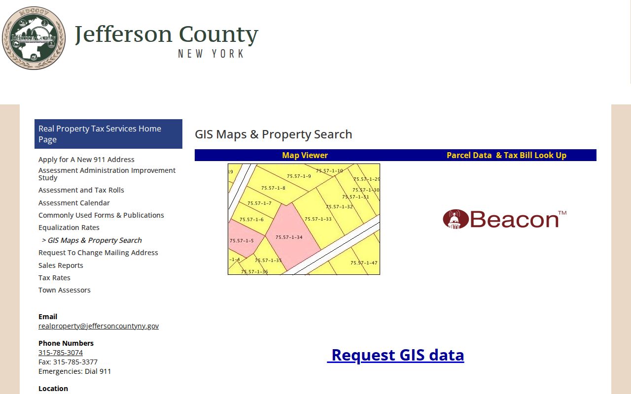
The gateway image reinforces why a Town of Le Ray street directory search should pair parcel identification with mapped geography instead of relying on a mailing label alone.
Address Records Across Le Ray
No single Town of Le Ray street directory source answers every address question. The records below are keyed to an address, parcel, legal description, or street number, but each holds a different kind of evidence. Parcel and GIS records establish geographic context. A recorded deed traces parties to a transaction. Planning files show an application or decision. A historical directory can place a dated name at a street number, subject to its regional and publication limits.
| Address-keyed source | What it may show | Access channel |
|---|---|---|
| Parcel and tax record | Situs address, tax-map number, owner field, tax context | SDG portal or Jefferson County Real Property |
| GIS parcel viewer | Parcel geometry, roads, districts, flood and zoning context | County viewer or GIS data request |
| Recorded deeds and maps | Grantor, grantee, legal description, instrument and recording date | SearchIQS, Clerk office self-search, or Records Management request |
| Planning or zoning file | Application, parcel, site plan, SEQR material, approval or enforcement trail | Town office or a focused FOIL request |
| Dated directory entry | Historical street-number and name lead | Flower Library or NY Heritage, with Watertown regional limits |
The County Clerk's deed series reaches from 1793 to the present, while online SearchIQS availability is documented from 2014. Maps have a back file to 1959. If a Town of Le Ray street search needs older deeds or books, use the free office self-search route, ask whether the needed series is onsite, or send a Records Management request naming the person, year range, and document type. Copies and search fees can apply, so confirm the current schedule first.
Le Ray Planning Records by Parcel
A planning or zoning file can add the public project history of a Town of Le Ray parcel. The Town Planning office describes applications, site plans, subdivisions, special-use permits, lot-line adjustments, SEQR material, meeting records, and decisions. Its process requires a complete PDF by email and one physical copy before the stated deadline. Those materials can identify a parcel, project, applicant role, board action, and date. A named applicant, engineer, owner, or representative is not necessarily a resident.
No indexed public planning-board application archive or permit-result database was found. The practical fallback is the Town Planning or Zoning office, followed by a written FOIL request to the Town Clerk if a record is not posted. Describe the board, address or parcel, approximate date range, project type, and requested items such as the application, site plan, EAF, minutes, resolution, or correspondence. Ask for electronic copies where reasonable.
Note: A narrow address-and-date request is more likely to reach the correct town record than a request for every file about a person.
Parcel Terms for Le Ray Streets
Town of Le Ray street records use several labels that look alike but answer separate questions. Keeping the terms apart makes an address search easier to repeat and less likely to confuse a property party with an occupant. The legal description and tax-map number are the strongest bridges between the parcel viewer and the deed index. A historical street number belongs with the date and source that printed it.
- Parcel
- A defined piece of land recorded in the tax and map system, often tied to a tax-map number.
- Situs address
- The physical address assigned to a parcel. It is different from a party's mailing address.
- Plat
- A map or plan that can show lot boundaries, subdivisions, or related parcel geometry.
- Criss-cross directory
- A historical directory arranged by street or number rather than solely by personal name.
A street name can also be a weak match. Preserve the original spelling from the record, then compare it with the current mapped road and legal description. The research did not locate an official Le Ray street-renumbering history, so no renumbering year should be assumed.
Le Ray Street Records Go Digital
Jefferson County has been expanding access to older records, but digitization does not mean every Town of Le Ray street record is searchable online. County materials document SearchIQS availability from 2014, a map scanner acquired in 2016 with a back file to 1959, and a book scanner acquired in 2023. A June 2025 local report described page-by-page preservation of deeds, maps, court records, and older books. The useful question for an address search is whether the particular deed, map, or book has been scanned and indexed.
The County Clerk land-record route, office self-search, and Records Management mail request remain part of the same workflow. If an online search ends before the needed date, ask for the relevant series and legal description rather than assuming the record does not exist. The county records-search form permits document-type choices and a narrow year range, which can reduce unrelated copy charges and results.
Note: County digitization improves access, but it does not convert a partial index into a complete street history.
Postal Labels on Le Ray Streets
A Town of Le Ray address may use an Evans Mills, Calcium, Fort Drum, Watertown, or Black River postal clue. Postal city and civil town are separate systems. The official Town Hall address confirms Evans Mills 13637 for that address only, not for every town street. The USPS tool is the right source for the current postal label, while county GIS is the right source for municipal geography and the parcel portal is the right source for tax-map context.
Keep a PO Box, mailing address, and situs address in separate fields. Postal validation is useful when the street directory search begins with an incomplete address, but USPS expressly warns that its result does not confirm a person or business at an address. For ZIP-specific work, the Town of Le Ray ZIP code directory keeps the postal boundary question separate from the street-by-street record chain.
Historical Le Ray Address Leads
Historical directories can supply a useful address lead, especially when a deed or map points to an older name or number. Flower Memorial Library's genealogy service focuses on Jefferson County research and offers in-house searching, copies, mail requests, email, and brief telephone questions. The nearby NY Heritage Watertown City Directories collection is a regional comparison source, with non-consecutive titles from 1855 through 1916 and an item record for 1840. It is not a Le Ray resident roll.
The 1902 directory includes street, residence, business, government, and institution sections. Its preface says the street portion intended to list streets, intersections, house numbers, and occupants, while also warning that errors could remain. Use that combination as a dated lead. A Watertown entry, including the observed 37 LeRay address example, needs a map, deed, or other separate connection before it is treated as evidence about Town of Le Ray.
Limits of Le Ray Street Records
Town of Le Ray street records cannot provide a complete list of people at an address. Parcel fields concern land and recorded ownership. Deeds concern parties and instruments. Planning files concern applications and decisions. A voter query is restricted and is not an unrestricted street search. Directory entries are dated snapshots, and the available historical collection is regional. A no-result may mean the record is outside the database, protected, or held through an office channel rather than online.
Lawful use. Use Town of Le Ray address records only for lawful personal research, property history, family-history, or civic questions. Do not use a record to stalk, harass, intimidate, or expose a protected person.
New York's Address Confidentiality Program and confidential voter-registration rules can shield an address. A FOIL request also does not authorize republishing exempt personal information. Preserve the source and date for each result, remove protected contact details and minor information, and confirm material claims with the custodian that holds the record.