
Sources for Le Ray Neighbors on One Block
The public record for a Le Ray block is split across several systems. The county GIS shows adjoining parcel shapes, roads, and map layers. The tax portal can connect a parcel to the owner field and tax context. County Clerk deeds and maps show recorded parties and legal parcel relationships. Town planning and zoning files can be searched by address or parcel through a request, but a named applicant is not necessarily a resident. These records answer different questions and should remain separate.
| Source | What It Shows About a Block | Access |
|---|---|---|
| Jefferson County GIS | Adjacent parcel polygons, roads, and municipal, election, school, flood, and zoning layers | Public map viewer; live identify controls need browser confirmation |
| Parcel and tax portal | Parcel-by-parcel owner and tax fields after address or map identification | County SDG lookup |
| County Clerk deeds and maps | Recorded party changes and legal parcel relationships | SearchIQS or office request |
| Voter record route | Lawful individual registration or polling lead, not a block roster | NYS lookup or election-purpose FOIL |
| Town planning and zoning files | Address-keyed applications, decisions, maps, and related records | Town office or FOIL request |
The owner field is not a household list. A parcel can be held by someone with a different mailing address, and neither a parcel nor a deed identifies every person associated with the location. The most accurate result identifies the source, record date, and the particular role shown.
Le Ray Neighbors Through GIS Layers
The Jefferson County GIS and property-search gateway is the right starting point for the immediate physical setting. County documentation describes aerial, agricultural-district, land-use, zoning, school, election, flood, municipal, and address layers. These layers explain the geography around a parcel. They do not establish a private household, and a layer should not be used to infer a person's identity or status.
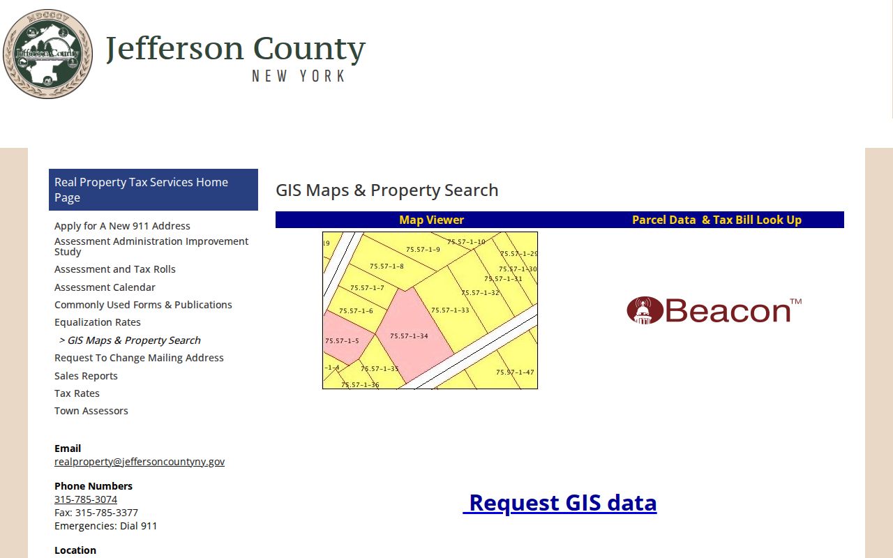
The county gateway joins GIS context with the real-property route. During research, the live GIS inspection was limited by script and Cloudflare behavior, so the exact identify, export, adjacent-select, buffer, and radius controls should be confirmed in a browser before relying on them.
Use the map to locate the subject parcel, zoom to the street segment, and write down each adjoining parcel identifier before opening a tax record. That sequence avoids guessing from a marker or from a nearby road label. If a boundary remains unclear, the county GIS office is the better source than a postal address label.
Note: GIS layers provide location context, while the tax record and recorded document remain separate sources for names and legal relationships.
Le Ray Neighbor Searches Respect Address Roles
Address-keyed records use several different names for people connected with a property. The SDG portal may identify an owner and display a situs address, the physical parcel location. A mailing address can be for tax correspondence and may be outside Le Ray. The deed index records a grantor or grantee. A planning file can identify an applicant, owner, engineer, or representative. An election record has its own separate protections and use rules. Each label should be kept in the research note rather than treated as a statement that a person lives there.
- Tax-map number
- A county parcel identifier used to connect the map and tax record.
- Situs address
- The parcel's physical location, not necessarily the owner's mailing address.
- Legal description
- The recorded land description used to follow the same parcel across deed records.
- Adjacent parcel
- A parcel sharing a boundary or immediate map relationship with the subject parcel. It is not a statement about personal relationships.
Recorded deeds can help explain why the owner field changed. SearchIQS online availability is documented from 2014, while the County Records Center has deed coverage from 1793 to the present. Older material, copies, and pre-1967 searching can require a different clerk or Records Center route. For the complete named-street record chain, use the Town of Le Ray street directory rather than trying to stretch a block search across an entire street.
Le Ray Neighbors and Voter Files
New York's voter lookup is not a street-browse tool. It visibly asks for County, last name, first name, date of birth, and ZIP Code, with additional address controls not reliably labeled in the text inspection. The system can support a permitted individual query, but it cannot be used to build a block roster from scattered searches. Registration is not a current occupancy finding, and protected registrations must remain protected.
The NYS Voter Lookup makes its county, name, date-of-birth, and ZIP inputs visible. Jefferson County Elections handles local forms, district shapefiles, and questions about local registration data. A county or state voter-file request requires an election-purpose certification under N.Y. Election Law §3-103(5). The statute also restricts knowing and willful misuse under §17-168.
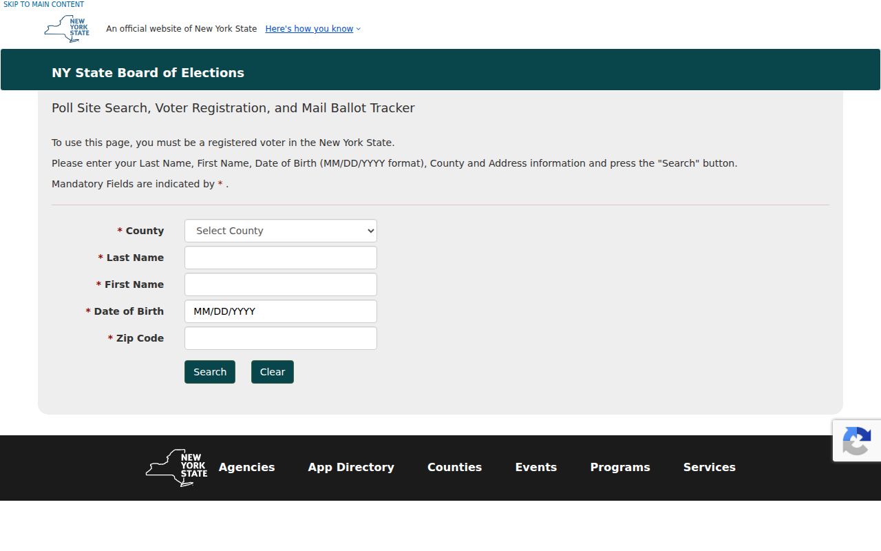
The official interface asks for identifying information instead of offering a map of names. District shapefiles and county GIS election layers are better sources for explaining why nearby addresses have different districts or polling places.
Confidential registration has separate protection under Executive Law §108 and 19 NYCRR Part 134. When a record is protected, the correct response is to respect that protection, not to combine maps, address leads, or other records to reconstruct it.
Le Ray Community Directory Gap
No verified official Town of Le Ray neighborhood-association, HOA, block-watch, congregation, civic-club, or umbrella-directory roster was located in the research. That is a gap in the documented access routes, not evidence that no local groups exist. It also means a private group name, a subdivision label, or an informal social post should not be treated as a current neighborhood boundary or contact source.
| Local route | Verified use | What to ask for |
|---|---|---|
| Flower Memorial Library | Jefferson County directories, local history, vital microfiche, obituary, newspaper, and genealogy leads | Give a surname, place, approximate year, and record type |
| Jefferson County Historical Society | Museum collections, photographs, portraits, and county-history context | Ask for collection title and date, then verify the lead in a primary record |
| LeRay Historical Museum | Local industry, education, military history, and notable-resident context | Request an exhibit or collection reference, not an unverified roster |
| Town planning office | Planning files, maps, applications, resolutions, and decisions | Specify address or parcel, project type, and approximate date range |
Flower Memorial Library's genealogy resource is at 229 Washington Street in Watertown, with genealogy service at 315-785-7711. The research describes its in-house search as free, with copies charged per page plus postage. Watertown is a library and history hub for the county, but its nearby collections must not be relabeled as proof that a historic entry occurred in Le Ray.
Le Ray Neighbors Need Geography Checks
Town of Le Ray has several named-place and postal clues that need to remain distinct. Evans Mills, Calcium, Le Raysville, Black River, and the Fort Drum area can appear in a research trail, but a postal city is not the same thing as a civil town boundary. The county locator map and GIS layers are safer than assigning a parcel to a municipality from a mailing label alone. The Black River edge is one example where a parcel check matters.
Fort Drum is a major geographic context for Le Ray, not a personnel directory. A tax parcel, town permit, or mailing label can describe civil geography but cannot establish military status. The town's official history and the county locator materials provide orientation, while the county GIS address database can help resolve a mismatch between a mailing label and municipal location.
Map a Le Ray Block With Parcels
A block-level lookup should be short and methodical. The objective is to understand the parcels touching or immediately surrounding a known address, not to assemble a personal profile of people nearby. Record the parcel identifier and map date first. Then move to the appropriate county record when an owner field, legal description, or recorded transfer needs confirmation.
- Enter the known address in the county map or parcel system and confirm that the result is the right Le Ray location.
- Identify the subject parcel, zoom to the immediate street segment, and note the parcel IDs for the polygons beside it.
- Open each parcel's tax result and record only the owner field, parcel identifier, situs address, and source date that the record shows.
- Use the County Clerk land-record route to compare legal description, grantor, grantee, and recording date when a parcel relationship needs a historical check.
- For an address-keyed town record, send a focused FOIL request naming the board, parcel or address, approximate date range, and requested document type.
The Town of Le Ray planning secretary is listed at 315-629-7101 and clerk@townofleray.org, with Monday through Friday hours of 8:30 to 4. Planning applications need a complete PDF by email and a physical copy, with a deadline stated as the second Friday before a scheduled board meeting. A request for a planning record should capture application date, meeting date, applicant or owner role, parcel, project type, and decision status without assuming any participant lived at the site.
Note: An address, parcel, and legal description should be checked together before a deed chain or town file is matched to a Le Ray block.
Le Ray Neighbor Lookup Privacy
Official records are stronger than commercial neighbor-finding categories because they identify a custodian, date, and defined scope. A commercial category may combine public and purchased data, charge a subscription or report fee, and still contain stale or mismatched information. Neither category replaces a custodian record. For a parcel question, use the county map, tax portal, and deed route. For a historical name lead, use library or archive holdings and preserve the date.
| Research route | Strength | Boundary |
|---|---|---|
| County parcel, GIS, or deed record | Names the record keeper, parcel context, and recorded role | Does not identify every person associated with an address |
| Commercial neighbor-finding category | May offer a starting lead | Can be stale, mismatched, or unclear about the underlying source |
| Library or archive collection | Supplies dated historical context and regional directory leads | Must be verified before treated as a current Le Ray fact |
New York's Address Confidentiality Program protects eligible participants through a substitute address, and confidential voter registration has separate safeguards. Do not try to expose or reconstruct protected details. Keep only the minimum facts necessary for lawful research, preserve the source and date, and ask the original custodian to correct an error.
Lawful use. Information about Town of Le Ray neighbors is for personal, lawful research and block awareness. Do not use records or maps to stalk, harass, intimidate, or harm anyone.